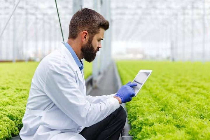
Best Precision Agriculture Software for Farms in the State of Mato Grosso
Precision agriculture software helps farmers collect, analyze, and apply information about fields, crops, soil conditions, machinery, and weather. Instead of treating every part of a farm identically, these systems support decisions based on differences between field locations. For farms in Mato Grosso, where soybean, corn, cotton, and other agricultural activities contribute to a substantial farming sector, digital agriculture can help coordinate complex operations across extensive cultivated areas.
Modern precision farming combines satellite imagery, geographic information systems, GPS guidance, field sensors, machinery data, and farm management software. These technologies help users monitor crop development, organize field operations, identify unusual conditions, and maintain records throughout the growing season. Their usefulness depends on data quality, connectivity, equipment compatibility, and the ability of farm teams to interpret the information.
The search for the best precision agriculture software for farms in Mato Grosso should therefore begin with operational requirements rather than brand popularity. A family-operated farm may prioritize straightforward field mapping and activity records, while a large agricultural enterprise may need machinery integration, remote monitoring, team coordination, and detailed reporting.
Understanding the main software categories makes comparison easier. This guide examines their functions, practical applications, selection criteria, industry developments, and implementation considerations for farms operating in Mato Grosso.
Who it affects and what problems it solves
Precision agriculture software is relevant to farm owners, agronomists, machinery operators, agricultural consultants, crop managers, cooperatives, and organizations supporting agricultural production. Each group uses farm information differently, but all can benefit from reliable records and clearer operational visibility.
One major challenge is variability within fields. Soil characteristics, drainage, elevation, moisture, and crop development can differ considerably across a single cultivated area. Satellite monitoring and field mapping can help identify these differences, allowing agronomists to investigate specific locations instead of relying exclusively on whole-field averages.
Another challenge is coordinating machinery and field activities during demanding planting, spraying, and harvesting periods. Farm management software can organize schedules, document completed operations, and consolidate information from multiple machines or teams. GPS guidance systems can also support accurate driving patterns and reduce unnecessary overlaps when correctly configured.
Data fragmentation is a further problem. Yield records, fertilizer applications, seed information, machinery logs, and weather observations may be stored in separate systems. Integrating these records can improve traceability and help managers compare operational results across fields and seasons.
However, adopting technology does not automatically improve agricultural outcomes. Inaccurate field boundaries, outdated equipment settings, inconsistent data entry, and weak internet connectivity can limit usefulness. Another common mistake is purchasing advanced functionality before identifying a specific operational need.
For farms in Mato Grosso, the practical objective is to connect reliable field information with decisions about inputs, machinery, labor allocation, and crop performance. Software should support agronomic judgment rather than replace it.
Recent updates and industry trends
Over the past year, agricultural technology development has continued to emphasize connected machinery, remote sensing, artificial intelligence, and integrated farm data. Many agricultural organizations globally are exploring ways to combine satellite imagery, weather information, machine telemetry, and historical production records within a unified decision-making environment.
Satellite-based crop monitoring has become increasingly useful for identifying changes in vegetation, comparing field conditions, and prioritizing scouting activities. Some platforms combine vegetation indices with weather observations and field histories to help users investigate areas that may require attention. Satellite indicators remain indirect measurements, however, and should be interpreted alongside field observations.
Artificial intelligence is also influencing precision farming software. Emerging applications include automated image interpretation, anomaly detection, operational summaries, and predictive analysis. The reliability of these functions depends on the underlying datasets, local conditions, and validation procedures.
Machinery connectivity is another important development. Farm platforms increasingly support data exchange between guidance systems, application equipment, yield monitors, and management applications. Compatibility remains a significant consideration because different manufacturers may use different data formats and integration arrangements.
For Mato Grosso, connectivity deserves particular attention because agricultural operations may extend across remote areas. Offline data collection, synchronization when connectivity returns, and clear procedures for transferring field records can help maintain continuity. Digital security, user permissions, and data ownership are also becoming more important as farms consolidate more operational information into software systems.
Comparison of precision agriculture software categories
The following comparison examines common software categories rather than ranking individual brands. Actual capabilities depend on the specific platform, subscription configuration, equipment, and available integrations.
| Comparison point | Farm management software | Satellite monitoring | GPS guidance software | Variable-rate software | Integrated platforms |
|---|---|---|---|---|---|
| Main purpose | Organize farm operations | Monitor crop conditions | Support accurate navigation | Adjust application rates | Combine farm data |
| Efficiency | Operational coordination | Faster remote assessment | Consistent field passes | Targeted input application | Cross-system visibility |
| Automation | Moderate to high | Moderate | High when equipment supports it | High with compatible machinery | Varies by configuration |
| Scalability | Suitable for multiple fields | Broad geographic coverage | Depends on machinery | Depends on equipment | Often designed for large operations |
| Maintenance | Records and system updates | Data and account management | Calibration and equipment checks | Prescription updates | Integration maintenance |
| Flexibility | High | High | Equipment-dependent | Agronomy-dependent | Depends on integrations |
| Speed | Quick record access | Depends on image availability | Real-time guidance | Depends on preparation | Depends on data synchronization |
| Reliability | Depends on data quality | Affected by imagery conditions | Depends on signal and calibration | Depends on prescriptions | Depends on connected systems |
| Energy use | Device-dependent | Limited field equipment requirements | Machinery-dependent | Machinery-dependent | Infrastructure-dependent |
| Implementation complexity | Low to high | Low to moderate | Moderate | High for complex workflows | Moderate to high |
| Integration capability | Often supports multiple records | May connect to field maps | Requires compatible hardware | Requires compatible controllers | Central design priority |
| Connectivity needs | Varies; offline support helps | Usually needs data access | Can operate with suitable positioning equipment | Varies by equipment | Often benefits from stable connectivity |
Farm management software is a practical starting point for organizations that need consistent records and operational coordination. Satellite monitoring is particularly useful for reviewing large areas and identifying locations for closer inspection. GPS guidance and variable-rate systems are more closely tied to machinery, field configuration, and agronomic planning.
Integrated platforms can reduce fragmentation, but they may require more preparation and technical support. The appropriate choice depends on the farm's size, equipment, staff capabilities, existing records, and the decisions the software is expected to improve.
Regulations and practical guidance
Selecting precision agriculture software requires attention to data quality, equipment safety, environmental management, privacy, and applicable regulatory requirements. International standards and established information-management practices can help organizations develop consistent processes, although the relevant requirements depend on the software's purpose and the farm's activities.
For agricultural machinery, guidance systems and automated application equipment should be configured according to manufacturer instructions. Operators need appropriate training, and application settings should be checked before field operations. Software-generated prescriptions should receive agronomic review, particularly when they influence fertilizer, pesticide, irrigation, or other input applications.
Farms operating in Mato Grosso should also consider applicable Brazilian requirements for agricultural inputs, environmental protection, rural operations, and digital records. Requirements can differ according to the activity and product involved, so software records should not be treated as automatic proof of compliance. Qualified local professionals can help determine which documentation and procedures apply.
Data governance is equally important. Farm managers should understand who can access operational records, how information is stored, whether it can be exported, and what happens if a platform or service changes. Regular backups, strong authentication, controlled user permissions, and documented data-transfer procedures reduce operational risks.
Environmental considerations include responsible input application, monitoring of field variability, and accurate documentation of agricultural activities. Precision technology can support these practices, but results depend on appropriate agronomic decisions and careful implementation.
Before selecting a platform, farms should test representative field data, verify compatibility with existing machinery, and establish measurable objectives. Useful measures include record completeness, field-operation accuracy, machinery utilization, and the time required to prepare reports.
Which option suits different situations?
Small operations: Begin with straightforward farm management software, digital field maps, weather information, and basic satellite monitoring. Ease of use and dependable records may matter more than advanced automation.
Large-scale farms: Consider integrated farm management systems that connect machinery data, field operations, crop monitoring, input records, and reporting across multiple properties or teams.
Beginners: Prioritize clear interfaces, training resources, simple reporting, and practical support. Introduce advanced functions gradually after establishing reliable field records.
Experienced professionals: Evaluate variable-rate application, prescription mapping, yield analysis, and machinery integration when these capabilities address defined agronomic or operational requirements.
Growing organizations: Choose software that supports additional users, fields, machines, and data sources without requiring a complete replacement of existing workflows.
Tools and resources
The following tools and resources can help farms assess precision agriculture software and develop a more organized digital workflow.
Farm management information systems — Consolidate field activities, input records, planting dates, and operational reports.
Geographic information systems — Support field-boundary mapping, spatial analysis, and the organization of geographic data.
Satellite crop-monitoring platforms — Help users review vegetation patterns and identify areas for field inspection.
GPS guidance and steering systems — Support accurate machinery navigation when paired with compatible positioning equipment.
Variable-rate prescription tools — Help agronomists create application maps based on soil tests, yield data, and field observations.
Yield mapping and analysis software — Organize harvest data to compare performance across fields and seasons.
Connectivity and equipment compatibility checklists — Help teams evaluate data formats, offline functions, machinery support, and export capabilities before implementation.
FAQs
What is precision agriculture software?
Precision agriculture software collects and analyzes information about fields, crops, machinery, weather, and agricultural activities. It can support field mapping, crop monitoring, operational planning, yield analysis, and variable-rate application. Some platforms focus on a single function, while integrated systems combine several workflows. The most appropriate system depends on farm objectives, equipment compatibility, data availability, and the experience of the people using it.
Which precision agriculture software is suitable for Mato Grosso farms?
The appropriate platform depends on farm size, crop mix, machinery, connectivity, and management priorities. Farm management systems can support operational records, satellite tools can help monitor large cultivated areas, and variable-rate applications can support site-specific input management. Farms should compare these capabilities using their own field data and verify compatibility with existing equipment before committing to a particular technical approach.
Can precision agriculture software reduce agricultural input waste?
Precision agriculture software can help identify field variability, improve application planning, and document how inputs are used. GPS guidance may reduce unnecessary overlaps, while variable-rate systems can adjust application quantities according to suitable prescriptions. Results are not guaranteed and depend on calibration, agronomic recommendations, equipment performance, and field conditions. Monitoring actual outcomes is essential when evaluating whether a particular workflow improves resource efficiency.
Does precision agriculture software require constant internet access?
Not necessarily. Some systems support offline field records, local mapping, or machinery functions that continue operating without a continuous internet connection. However, satellite imagery downloads, cloud synchronization, remote reporting, and certain analytics may require connectivity. Farms in remote areas should test offline capabilities, understand synchronization procedures, and establish reliable backup methods before making the software central to daily operations.
What should farms evaluate before adopting precision agriculture software?
Farms should assess ease of use, equipment compatibility, data ownership, security, integration capability, technical support, and reporting functions. They should also identify specific operational objectives and establish measurable indicators for evaluating results. A pilot project using representative fields can reveal data-quality problems and training requirements before broader implementation. Future developments in artificial intelligence and connected machinery may expand capabilities, but reliable data and sound agronomic judgment will remain essential.
Conclusion
The best precision agriculture software for farms in Mato Grosso depends on the operational challenges a farm needs to address. Farm management platforms support coordination and recordkeeping, satellite monitoring helps identify field variability, GPS guidance supports machinery accuracy, and variable-rate systems enable site-specific application when suitable data and equipment are available. Integrated platforms can connect these functions, although they may require more extensive preparation and technical support.
A practical selection process begins with clear objectives, an assessment of existing machinery, and an understanding of connectivity limitations. Farms should compare data compatibility, offline functions, security controls, training requirements, and reporting capabilities. Testing a platform on representative fields can help determine whether its features address genuine operational needs.
Looking ahead, artificial intelligence, connected machinery, improved remote sensing, and more integrated agricultural datasets are likely to influence precision farming internationally. For Mato Grosso producers, the lasting value of these developments will depend on their ability to translate reliable information into sound field decisions, efficient operations, and responsible resource management.